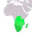
LocationSouthernAfrica.png (359 × 359 pixel, dimensione del file: 8 KB, tipo MIME: image/png)
Cronologia del file
Fare clic su un gruppo data/ora per vedere il file come si presentava nel momento indicato.
| Data/Ora | Miniatura | Dimensioni | Utente | Commento | |
|---|---|---|---|---|---|
| attuale | 14:16, 11 nov 2022 |  | 359 × 359 (8 KB) | ColorfulSmoke | . |
| 12:55, 11 nov 2022 |  | 360 × 359 (8 KB) | ColorfulSmoke | ||
| 17:54, 17 mar 2018 |  | 360 × 392 (11 KB) | Maphobbyist | Upload | |
| 22:22, 9 lug 2011 |  | 360 × 392 (14 KB) | Maphobbyist | South Sudan has become independent on July 9, 2011. Sudan and South Sudan are shown with the new international border between them. | |
| 09:11, 11 dic 2007 |  | 360 × 392 (14 KB) | Hoshie | added Cabinda (Angola) and Montenegro. | |
| 17:01, 2 apr 2006 |  | 360 × 392 (9 KB) | E Pluribus Anthony~commonswiki | Reverted to earlier revision | |
| 06:45, 1 apr 2006 |  | 360 × 392 (14 KB) | Aris Katsaris | Cleaner -- there's no need to include SADC at all here. | |
| 19:41, 5 feb 2006 |  | 360 × 392 (9 KB) | E Pluribus Anthony~commonswiki | Map: Southern Africa (location) |
Pagine che usano questo file
La seguente pagina usa questo file:
Utilizzo globale del file
Anche i seguenti wiki usano questo file:
- Usato nelle seguenti pagine di ace.wikipedia.org:
- Usato nelle seguenti pagine di af.wikipedia.org:
- Usato nelle seguenti pagine di als.wikipedia.org:
- Usato nelle seguenti pagine di am.wikipedia.org:
- Usato nelle seguenti pagine di ar.wikipedia.org:
- ليبيا
- جيبوتي
- موريتانيا
- تونس
- السودان
- الصحراء الغربية
- أنغولا
- أوغندا
- إسبانيا
- تشاد
- النيجر
- مالي
- السنغال
- غامبيا
- غينيا بيساو
- غينيا
- سيراليون
- ليبيريا
- غانا
- توغو
- بنين
- بوركينا فاسو
- الصومال
- كينيا
- تنزانيا
- الغابون
- زامبيا
- موزمبيق
- زيمبابوي
- البرتغال
- الكاميرون
- جمهورية الكونغو الديمقراطية
- بوتسوانا
- جنوب إفريقيا
- جمهورية إفريقيا الوسطى
- جمهورية الكونغو
- سيشل
- ناميبيا
- مدغشقر
- ليسوتو
- موريشيوس
- نهر النيل
Visualizza l'utilizzo globale di questo file.


