Technopedia Center
PMB University Brochure
Faculty of Engineering and Computer Science
S1 Informatics S1 Information Systems S1 Information Technology S1 Computer Engineering S1 Electrical Engineering S1 Civil Engineering

faculty of Economics and Business
S1 Management S1 Accountancy

Faculty of Letters and Educational Sciences
S1 English literature S1 English language education S1 Mathematics education S1 Sports Education
teknopedia

teknopedia

teknopedia

teknopedia

teknopedia

teknopedia
teknopedia
teknopedia
teknopedia
teknopedia
teknopedia
  • Registerasi
  • Brosur UTI
  • Kip Scholarship Information
  • Performance
  1. Weltenzyklopädie
  2. File:Indiana in United States.svg - Teknopedia
File:Indiana in United States.svg - Teknopedia
  • File
  • Cronologia del file
  • Pagine che usano questo file
  • Utilizzo globale del file
  • Metadati
File:Indiana in United States.svg
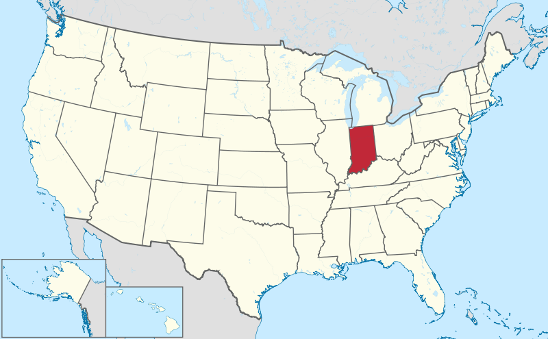
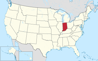
Dimensioni di questa anteprima PNG per questo file SVG: 800 × 495 pixel. Altre risoluzioni: 320 × 198 pixel | 640 × 396 pixel | 1 024 × 634 pixel | 1 280 × 792 pixel | 2 560 × 1 585 pixel | 1 181 × 731 pixel.

File originale (file in formato SVG, dimensioni nominali 1 181 × 731 pixel, dimensione del file: 3,46 MB)

Logo di Commons
Logo di Commons
Questo file e la sua pagina di descrizione (discussione · modifica) si trovano su Wikimedia Commons (?)

Dettagli

DescrizioneIndiana in United States.svg
Deutsch: Lage von Indiana in den Vereinigten Staaten.
English: Location of the state of Indiana in the United States
Data 30 luglio 2011
Fonte Opera propria
 
Questa mappa include elementi che sono stati presi o adattati da questa:
 Usa edcp location map.svg (di Uwe Dedering).
 
Questa mappa include elementi che sono stati presi o adattati da questa:
 USA Hawaii location map.svg (di NordNordWest).
 
Questa mappa include elementi che sono stati presi o adattati da questa:
 Canada location map.svg (di Yug).
Autore TUBS Gallery
Altre versioni

This SVG map is part of a locator map series applying the widespread location map scheme. Please see root category to browse for more.

More ▼

Africa
Algeria • Angola • Benin • Botswana • Burkina Faso • Burundi • Cameroon • Cape Verde • Central African Republic • Chad • Comoros • Côte d'Ivoire • Democratic Republic of the Congo • Republic of the Congo • Djibouti • Egypt • Equatorial Guinea • Eritrea • Eswatini • Ethiopia • Gabon • Gambia • Ghana • Guinea-Bissau • Guinea • Kenya • Lesotho • Liberia • Libya • Madagascar • Malawi • Mali • Mauritania • Mauritius • Morocco • Mozambique • Namibia • Niger • Nigeria • Rwanda • (Sahrawi Arab Democratic Republic) • Senegal • Seychelles • Sierre Leone • Somalia • Somaliland • South Africa • South Sudan • Sudan • São Tomé and Príncipe • Tanzania • Togo • Tunisia • Uganda • Yemen • Zambia • Zimbabwe

Asia
(Abkhazia) • Afghanistan • Armenia • Azerbaijan • Bahrain • Bangladesh • Bhutan • Brunei • Cambodia • People's Republic of China • Republic of China • Cyprus • East Timor • Egypt • Georgia • India • Indonesia • Iran • Iraq • Israel • Japan • Jordan • Kazakhstan • Kuwait • Kyrgyzstan • Laos • Lebanon • Malaysia • Maldives • Mongolia • Myanmar • Nepal • North Korea • (Northern Cyprus) • Oman • Pakistan • (Palestine) • Papua New Guinea • Philippines • Qatar • Russia • Saudi Arabia • Singapore • South Korea • (South Ossetia) • Sri Lanka • Syria • Tajikistan • Thailand • Turkey • Turkmenistan • United Arab Emirates • Uzbekistan • Vietnam • Yemen

Europa
(European Union) • (Abkhazia) • Albania • Andorra • Armenia • Austria • Azerbaijan • Belarus • Belgium • Bosnia and Herzegovina • Bulgaria • Czech Republic • Croatia • Cyprus • Denmark • Estonia • Finland • France • Georgia • Germany • Greece • (Guernsey) • Hungary • Iceland • Ireland • Italy • (Jersey) • Kazakhstan • (Kosovo) • Latvia • Liechtenstein • Lithuania • Luxembourg • Malta • (Isle of Man) • Moldova • Monaco • Montenegro • Netherlands • North Macedonia • (Northern Cyprus) • Norway • Poland • Portugal • Romania • Russia • San Marino • Serbia • Slovakia • Slovenia • (South Ossetia) • Spain • Sweden • Switzerland • Turkey • Ukraine • United Kingdom • Vatican City

America del Nord
Antigua and Barbuda • Bahamas • Barbados • Belize • Canada • Costa Rica • Cuba • Dominica • Dominican Republic • El Salvador • Grenada • Guatemala • Haiti • Honduras • Iceland • Jamaica • Mexico • Nicaragua • Panama • Saint Kitts and Nevis • Saint Lucia • Saint Vincent and the Grenadines • Trinidad and Tobago • United States

Oceania insulare
Australia • (Cook Islands) • Fiji • Indonesia • Kiribati • Marshall Islands • Micronesia • Nauru • New Zealand • (Niue) • Palau • Papua New Guinea • Samoa • Solomon Islands • Tonga • Tuvalu • Vanuatu

America meridionale
Argentina • Bolivia • Brazil • Chile • Colombia • Ecuador • Guyana • Panama • Paraguay • Peru • Suriname • Trinidad and Tobago • Uruguay • Venezuela

Antartide
-
Locator maps design recommendations ▼
Principles
Design Guidelines are based on ▸location map design of the German map shop (in German). It's preferable to derive new locator maps from existing location maps. Please keep both size and ratio in this case. Thus the new locator maps may still be applied as location map (▸Guide). Marker color is supposed to be darkred. Waterbodies may be transparent, to show other objects better. Please be aware that this guide is only a recommendation. It’s not an inevitable law!
  • Color template
    Color template
  • Template toolbox
    Template toolbox
  • Other optional map elements
    Other optional map elements
  • Subdivision of a country
    Subdivision of a country
  • Country within an international organization
    Country within an international organization
  • Country without context projected on the globe
    Country without context projected on the globe
  • Country without context
    Country without context
Highlight small areas
  • Marker
    Marker
  • Merged markers
    Merged markers
  • “Glowing” edges
    “Glowing” edges
  • Zoom
    Zoom
  • Zoom
    Zoom
  • Zoom
    Zoom
“Remote” areas and mini maps
Mini maps show where the depicted area actually is situated. Check out ▸Vorlage:Positionskarte+ (in German) and ▸Modèle:Carte en coin (in French) of how to insert a mini map in virtually every map.
  • Small maps apply different scales
    Small maps apply different scales
  • Small map applies same scale as main map
    Small map applies same scale as main map
  • Mini map with box
    Mini map with box
  • Depicted continent dark grey
    Depicted continent dark grey
  • Zoomed box on a world map also showing the remote part of country
    Zoomed box on a world map also showing the remote part of country
Disputed areas
  • rest of Serbia: foreign or the same country?
    rest of Serbia: foreign or the same country?
  • Kosovo: part of Serbia?
    Kosovo: part of Serbia?
  • Whether South Ossetia or Abkhazia form a part of Georgia is disputed. The marked Georgian administrative region however is partly under Georgian control (solid red) while other parts are part break-away "country" South Ossetia (hatched).
    Whether South Ossetia or Abkhazia form a part of Georgia is disputed. The marked Georgian administrative region however is partly under Georgian control (solid red) while other parts are part break-away "country" South Ossetia (hatched).
  • India claims some northern areas (hatched) while other areas are controlled by India but challenged by other countries. India claims all of Kashmir (red areas), while it controls only the southern part of it (cf. broad red stripes vs. narrow red stripes).
    India claims some northern areas (hatched) while other areas are controlled by India but challenged by other countries. India claims all of Kashmir (red areas), while it controls only the southern part of it (cf. broad red stripes vs. narrow red stripes).
  • Western Sahara: part of Morocco?
    Western Sahara: part of Morocco?
  • Like above. However, the map differentiates whether the disputed area is controlled by Morocco or not.
    Like above. However, the map differentiates whether the disputed area is controlled by Morocco or not.
  • Locator map of Taiwan in China. Map hatches all areas that are claimed but not controlled by China. Hence, highlighted Taiwan is also hatched grey/red.
    Locator map of Taiwan in China. Map hatches all areas that are claimed but not controlled by China. Hence, highlighted Taiwan is also hatched grey/red.
Greyed special objects
  • Glaciers
    Glaciers
  • Urbanized areas
    Urbanized areas
Backgrounds
  • Relief
    Relief
  • Relief (like before, but outlines highlighted)
    Relief (like before, but outlines highlighted)
  • Satellite view
    Satellite view
  • Land cover
    Land cover
  • Relief
    Relief
Corresponding imagemaps ▼

Africa
Algeria • Angola • Benin • Botswana • Burkina Faso • Burundi • Cameroon • Cape Verde • Central African Republic • Chad • Comoros • Côte d'Ivoire • Democratic Republic of the Congo • Repbulic of the Congo • Djibouti • Egypt • Equatorial Guinea • Eritrea • Ethiopia • Gabon • Gambia • Ghana • Guinea-Bissau • Guinea • Kenya • Lesotho • Liberia • Libya • Madagascar • Malawi • Mali • Mauritania • Mauritius • Morocco • Mozambique • Namibia • Niger • Nigeria • Rwanda • (Sahrawi Arab Democratic Republic) • Senegal • Seychelles • Sierre Leone • Somalia • South Africa • South Sudan • Sudan • Swaziland • São Tomé and Príncipe • Tanzania • Togo • Tunisia • Uganda • Yemen • Zambia • Zimbabwe

Asia
(Abkhazia) • Afghanistan • Armenia • Azerbaijan • Bahrain • Bangladesh • Bhutan • Brunei • Cambodia • Peiple's Republic of China• Republic of China • Cyprus • East Timor • Egypt • Georgia • India • Indonesia • Iran • Iraq • Israel • Japan • Jordan • Kazakhstan • Kuwait • Kyrgyzstan • Laos • Lebanon • Malaysia • Maldives • Mongolia • Myanmar • Nepal • North Korea • (Northern Cyprus) • Oman • Pakistan • (Palestine) • Papua New Guinea• Philippines • Qatar • Russia • Saudi Arabia • Singapore • South Korea • (South Ossetia) • Sri Lanka • Syria • Tajikistan • Thailand • Turkey • Turkmenistan• United Arab Emirates • Uzbekistan • Vietnam • Yemen

Europa
(Abkhazia) • Albania • Andorra • Armenia • Austria • Azerbaijan • Belarus • Belgium • Bosnia and Herzegovina • Bulgaria • Czech Republic • Croatia • Cyprus • Denmark • Estonia • Finland • France • Georgia • Germany • Greece • (Guernsey) • Hungary • Iceland • Ireland • Italy • (Jersey) • Kazakhstan • (Kosovo) • Latvia • Liechtenstein • Lithuania • Luxembourg • Macedonia • Malta • (Isle of Man) • Moldova • Monaco • Montenegro • Netherlands • (Northern Cyprus) • Norway • Poland • Portugal • Romania • Russia • San Marino • Serbia • Slovakia • Slovenia • (South Ossetia) • Spain • Sweden • Switzerland • Turkey • Ukraine • United Kingdom • Vatican City

America del Nord
Antigua and Barbuda • Bahamas • Barbados • Belize • Canada • Costa Rica • Cuba • Dominica • Dominican Republic • El Salvador • Grenada • Guatemala • Haiti • Honduras • Iceland • Jamaica • Mexico • Nicaragua • Panama • Saint Kitts and Nevis • Saint Lucia • Saint Vincent and the Grenadines • Trinidad and Tobago • United States

Oceania insulare
Australia • Brunei • (Cook Islands) • East Timor • Fiji • Indonesia • Kiribati • Marshall Islands • Micronesia • Nauru • New Zealand • (Niue) • Palau • Papua New Guinea • Samoa • Solomon Islands • Tonga • Tuvalu • Vanuatu

America meridionale
Argentina • Bolivia • Brazil • Chile • Colombia • Ecuador • Guyana • Panama • Paraguay • Peru • Suriname • Trinidad and Tobago • Uruguay • Venezuela
Other

Antartide

Planisfero

Globo
SVG sviluppo
InfoField
 
Il codice sorgente di questo grosso file SVG non è valido a causa di 3 errori.
 
Questa grossa mappa in grafica vettoriale non valida secondo il W3C è stata creata con Adobe Illustrator da TUBS,
 
e con Inkscape.
 
This Adobe SVG locator map is very large because TUBS kept the superfluous Adobe PGF or other CDATA garbage
.

Licenza

Io, detentore del copyright su quest'opera, dichiaro di pubblicarla con la seguente licenza:
w:it:Creative Commons
attribuzione condividi allo stesso modo
Questo file è disponibile in base alla licenza Creative Commons Attribuzione-Condividi allo stesso modo 3.0 Unported
Tu sei libero:
  • di condividere – di copiare, distribuire e trasmettere quest'opera
  • di modificare – di adattare l'opera
Alle seguenti condizioni:
  • attribuzione – Devi fornire i crediti appropriati, un collegamento alla licenza e indicare se sono state apportate modifiche. Puoi farlo in qualsiasi modo ragionevole, ma non in alcun modo che suggerisca che il licenziante approvi te o il tuo uso.
  • condividi allo stesso modo – Se remixi, trasformi o sviluppi il materiale, devi distribuire i tuoi contributi in base alla stessa licenza o compatibile all'originale.
https://creativecommons.org/licenses/by-sa/3.0CC BY-SA 3.0 Creative Commons Attribution-Share Alike 3.0 truetrue
I'd greatly appreciate, that you attribute this media file to Wikimedia Commons, if used outside Teknopedia or Commons. For use in publications such as books, newspapers, blogs, websites, please insert here the following line:
{{published|author= |date= |url= |title= |org= }}
and fill the applicable fields. (Example). License terms given above still apply.

বাংলা ∙ Deutsch ∙ Deutsch (Sie-Form) ∙ Ελληνικά ∙ English ∙ español ∙ français ∙ Ἀρχαία ἑλληνικὴ ∙ Bahasa Indonesia ∙ 日本語 ∙ македонски ∙ Nederlands ∙ português ∙ русский ∙ Türkçe ∙ 简体中文 ∙ 繁體中文 ∙ +/−

Didascalie

Aggiungi una brevissima spiegazione di ciò che questo file rappresenta

Elementi ritratti in questo file

raffigura

creatore

Valore sconosciuto senza un elemento Wikidata

stringa del nome dell'autore: TUBS
nome utente nei progetti Wikimedia: TUBS
URL: http://commons.wikimedia.org/wiki/User:TUBS

stato del copyright

coperto da diritti d'autore

licenza

Creative Commons Attribuzione-Condividi allo stesso modo 3.0 Unported

origine del file

creazione originale della persona che ha caricato il file

data di fondazione o creazione

30 lug 2011

Cronologia del file

Fare clic su un gruppo data/ora per vedere il file come si presentava nel momento indicato.

Data/OraMiniaturaDimensioniUtenteCommento
attuale17:42, 30 lug 2011Miniatura della versione delle 17:42, 30 lug 20111 181 × 731 (3,46 MB)TUBS

Pagine che usano questo file

La seguente pagina usa questo file:

  • Indiana

Utilizzo globale del file

Anche i seguenti wiki usano questo file:

  • Usato nelle seguenti pagine di am.wikipedia.org:
    • ኢንዲያና
  • Usato nelle seguenti pagine di ang.wikipedia.org:
    • Indiǣna
  • Usato nelle seguenti pagine di ar.wikipedia.org:
    • إنديانا
  • Usato nelle seguenti pagine di ary.wikipedia.org:
    • إنديانا
  • Usato nelle seguenti pagine di arz.wikipedia.org:
    • انديانا
  • Usato nelle seguenti pagine di ast.wikipedia.org:
    • Indiana
  • Usato nelle seguenti pagine di azb.wikipedia.org:
    • ایندیانا
    • آدامز بؤلگه‌سی، ایندیانا
    • آلن بؤلگه‌سی، ایندیانا
    • واریک بؤلگه‌سی، ایندیانا
    • نوبل بؤلگه‌سی، ایندیانا
    • دکالب بؤلگه‌سی، ایندیانا
    • دوبویس بؤلگه‌سی، ایندیانا
    • اوهایو بؤلگه‌سی، ایندیانا
    • تیپتون بؤلگه‌سی، ایندیانا
    • ولز بؤلگه‌سی، ایندیانا
    • الخارت بؤلگه‌سی، ایندیانا
    • اوون بؤلگه‌سی، ایندیانا
    • فلوید بؤلگه‌سی، ایندیانا
    • پیک بؤلگه‌سی، ایندیانا
    • بنتون بؤلگه‌سی، ایندیانا
    • پوزئی بؤلگه‌سی، ایندیانا
    • بون بؤلگه‌سی، ایندیانا
    • ویتلئی بؤلگه‌سی، ایندیانا
    • جیبسون بؤلگه‌سی، ایندیانا
    • قرین بؤلگه‌سی، ایندیانا
    • ویقو بؤلگه‌سی، ایندیانا
    • هانکوک بؤلگه‌سی، ایندیانا
    • کارول بؤلگه‌سی، ایندیانا
    • کلارک بؤلگه‌سی، ایندیانا
    • کلای بؤلگه‌سی، ایندیانا
    • هاوارد بؤلگه‌سی، ایندیانا
    • جانسون بؤلگه‌سی، ایندیانا
    • شلبی بؤلگه‌سی، ایندیانا
    • مادیسون بؤلگه‌سی، ایندیانا
    • ماریون بؤلگه‌سی، ایندیانا
    • مورقان بؤلگه‌سی، ایندیانا
    • مونرو بؤلگه‌سی، ایندیانا
  • Usato nelle seguenti pagine di az.wikipedia.org:
    • İndiana
  • Usato nelle seguenti pagine di be.wikipedia.org:
    • Індыяна
  • Usato nelle seguenti pagine di bew.wikipedia.org:
    • Indiana
  • Usato nelle seguenti pagine di bg.wikipedia.org:
    • Индиана
  • Usato nelle seguenti pagine di bs.wikipedia.org:
    • Indiana
  • Usato nelle seguenti pagine di ca.wikipedia.org:
    • Indiana
  • Usato nelle seguenti pagine di cdo.wikipedia.org:
    • Indiana
  • Usato nelle seguenti pagine di ceb.wikipedia.org:
    • Gumagamit:Lsjbot/Duplicates/Indiana (estado)
  • Usato nelle seguenti pagine di ckb.wikipedia.org:
    • ئیندیانا
  • Usato nelle seguenti pagine di crh.wikipedia.org:
    • İndiana
  • Usato nelle seguenti pagine di cs.wikipedia.org:
    • Indiana
    • Seznam vlajek států Spojených států amerických

Visualizza l'utilizzo globale di questo file.

Metadati

Questo file contiene informazioni aggiuntive, probabilmente aggiunte dalla fotocamera o dallo scanner usati per crearlo o digitalizzarlo. Se il file è stato modificato, alcuni dettagli potrebbero non corrispondere alla realtà.

Larghezza1181px
Altezza731px
Estratto da "https://it.wikipedia.org/wiki/File:Indiana_in_United_States.svg"

  • Indonesia
  • English
  • Français
  • 日本語
  • Deutsch
  • Italiano
  • Español
  • Русский
  • فارسی
  • Polski
  • 中文
  • Nederlands
  • Português
  • العربية
Pusat Layanan

UNIVERSITAS TEKNOKRAT INDONESIA | ASEAN's Best Private University
Jl. ZA. Pagar Alam No.9 -11, Labuhan Ratu, Kec. Kedaton, Kota Bandar Lampung, Lampung 35132
Phone: (0721) 702022