Technopedia Center
PMB University Brochure
Faculty of Engineering and Computer Science
S1 Informatics S1 Information Systems S1 Information Technology S1 Computer Engineering S1 Electrical Engineering S1 Civil Engineering

faculty of Economics and Business
S1 Management S1 Accountancy

Faculty of Letters and Educational Sciences
S1 English literature S1 English language education S1 Mathematics education S1 Sports Education
teknopedia

teknopedia

teknopedia

teknopedia

teknopedia

teknopedia
teknopedia
teknopedia
teknopedia
teknopedia
teknopedia
  • Registerasi
  • Brosur UTI
  • Kip Scholarship Information
  • Performance
  1. Weltenzyklopädie
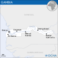
  2. File:Gambia - Location Map (2013) - GMB - UNOCHA.svg - Teknopedia
File:Gambia - Location Map (2013) - GMB - UNOCHA.svg - Teknopedia
  • File
  • Cronologia del file
  • Pagine che usano questo file
  • Utilizzo globale del file
  • Metadati
File:Gambia - Location Map (2013) - GMB - UNOCHA.svg
Dimensioni di questa anteprima PNG per questo file SVG: 250 × 250 pixel. Altre risoluzioni: 240 × 240 pixel | 480 × 480 pixel | 768 × 768 pixel | 1 024 × 1 024 pixel | 2 048 × 2 048 pixel.

File originale (file in formato SVG, dimensioni nominali 250 × 250 pixel, dimensione del file: 352 KB)

Logo di Commons
Logo di Commons
Questo file e la sua pagina di descrizione (discussione · modifica) si trovano su Wikimedia Commons (?)

Dettagli

DescrizioneGambia - Location Map (2013) - GMB - UNOCHA.svg
English: Locator map of Gambia.
Data 2013
Fonte
English: Gambia Locator Map (ReliefWeb), ESRI, UNCS
Autore
English: UN Office for the Coordination of Humanitarian Affairs (OCHA)
SVG sviluppo
InfoField
 
Il codice sorgente di questo file SVG è valido.
 
Questa mappa in grafica vettoriale è stata creata con Inkscape.
 
 This map uses embedded text that can be easily translated using a text editor.

Licenza

w:it:Creative Commons
attribuzione
Questo file è disponibile in base alla licenza Creative Commons Attribuzione 3.0 Unported
Attribuzione: OCHA
Tu sei libero:
  • di condividere – di copiare, distribuire e trasmettere quest'opera
  • di modificare – di adattare l'opera
Alle seguenti condizioni:
  • attribuzione – Devi fornire i crediti appropriati, un collegamento alla licenza e indicare se sono state apportate modifiche. Puoi farlo in qualsiasi modo ragionevole, ma non in alcun modo che suggerisca che il licenziante approvi te o il tuo uso.
https://creativecommons.org/licenses/by/3.0CC BY 3.0 Creative Commons Attribution 3.0 truetrue
This map is part of a collection of 216 free country maps, created by the UN Office for the Coordination of Humanitarian Affairs (OCHA), to be used in print, web or broadcast products.

The ReliefWeb Location Maps released here are maps that highlight a country, its capital, major populated places and the surrounding regions.

Attribution Requirements

Using the map without modifications: ensure that the sources and the disclaimer are below the map. Credit as follows: "Credit: OCHA".

For use with alteration: remove the OCHA logo and disclaimer following any modification to the map, but keep the data sources as mentioned below the map. Credit the modified map as follows: "Based on OCHA map". You are responsible for the content of your map.

We are keen to receive your feedback and hear how you used OCHA's maps. We would be grateful if you would notify us by e-mail and share your work with us.

UN Disclaimer
The designations employed and the presentation of material of this map do not imply the expression of any opinion whatsoever on the part of the Secretariat of the United Nations concerning the legal status of any country, territory, city or area or of its authorities or concerning the delimitation of its frontiers or boundaries.
VRT Wikimedia


L'autorizzazione per l'uso di quest'opera è stata verificata ed archiviata nel sistema VRT di Wikimedia ed è accessibile esclusivamente agli utenti con un account VRTS. Se vuoi riutilizzare quest'opera altrove, per favore consulta le indicazioni di Commons:Riuso del contenuto al di fuori di Wikimedia. Se sei un utente di Commons e desideri avere conferma dell'avvenuta autorizzazione o per eventuali richieste, per favore contatta qualcuno con un account VRTS oppure lascia una nota alla VRT noticeboard.

Link al ticket: https://ticket.wikimedia.org/otrs/index.pl?Action=AgentTicketZoom&TicketNumber=2014031410007248
Find other files from the same ticket: SDC query (SPARQL)


Il testo informativo (per esempio ora e data), una volta presente sull'immagine stessa, è stato spostato nei metadati dell'immagine e/o nella pagina di descrizione. Ciò facilita il riutilizzo dell'immagine in più contesti e più lingue, e rende il testo più facile da trattare e cercare. Commons scoraggia l'inserimento di informazioni testuali visibili nell'immagine. Tutte le licenze accettate su Commons permettono questo tipo di operazione come se si trattasse di un'opera derivata. Se le informazioni di attribuzione sono state rimosse e l'immagine non è nel pubblico dominio o free use, sostituisci questo template con {{Attribution metadata from licensed image}}.

беларуская (тарашкевіца)‎ | català | Deutsch | English | español | فارسی | français | galego | magyar | italiano | македонски | മലയാളം | português | русский | sicilianu | slovenščina | svenska | Indonesia | 中文 | +/−

Didascalie

Aggiungi una brevissima spiegazione di ciò che questo file rappresenta

Elementi ritratti in questo file

raffigura

stato del copyright

coperto da diritti d'autore

licenza

CC BY 3.0 Unported

numero di ticket VRTS

2014031410007248

data di fondazione o creazione

2013

tipo di file

image/svg+xml

Cronologia del file

Fare clic su un gruppo data/ora per vedere il file come si presentava nel momento indicato.

Data/OraMiniaturaDimensioniUtenteCommento
attuale16:12, 17 mar 2016Miniatura della versione delle 16:12, 17 mar 2016250 × 250 (352 KB)Wereldburger758Removal watermark. Validation of image.
21:43, 20 ago 2014Miniatura della versione delle 21:43, 20 ago 2014250 × 250 (405 KB)Pharos== {{int:filedesc}} == {{Information |description={{en|1=Locator map of Gambia.}} |date=2013 |source={{en|1=[http://reliefweb.int/map/gambia/gambia-location-map-2013 Gambia Locator Map (ReliefWeb)], ESRI, UNCS}} |author={{en|1=[[w:en:Un...

Pagine che usano questo file

Le seguenti 2 pagine usano questo file:

  • Confine tra il Gambia e il Senegal
  • Utente:Grizzy&TheLemmingsFan2763/Sandbox

Utilizzo globale del file

Anche i seguenti wiki usano questo file:

  • Usato nelle seguenti pagine di bh.wikipedia.org:
    • गांबिया
  • Usato nelle seguenti pagine di es.wikipedia.org:
    • Frontera entre Gambia y Senegal
  • Usato nelle seguenti pagine di gu.wikipedia.org:
    • ગામ્બિયા
  • Usato nelle seguenti pagine di id.wikipedia.org:
    • Gambia
    • Templat:Gambia infobox
  • Usato nelle seguenti pagine di mdf.wikipedia.org:
    • Гамбия
  • Usato nelle seguenti pagine di mnw.wikipedia.org:
    • ဂါမ္ဗဳယျာ
  • Usato nelle seguenti pagine di pl.wikipedia.org:
    • Gambia
  • Usato nelle seguenti pagine di pt.wikipedia.org:
    • Golpe de Estado na Gâmbia em 1994
  • Usato nelle seguenti pagine di sd.wikipedia.org:
    • گيمبيا

Metadati

Questo file contiene informazioni aggiuntive, probabilmente aggiunte dalla fotocamera o dallo scanner usati per crearlo o digitalizzarlo. Se il file è stato modificato, alcuni dettagli potrebbero non corrispondere alla realtà.

Larghezza250.00699
Altezza250.01399
Estratto da "https://it.wikipedia.org/wiki/File:Gambia_-_Location_Map_(2013)_-_GMB_-_UNOCHA.svg"

  • Indonesia
  • English
  • Français
  • 日本語
  • Deutsch
  • Italiano
  • Español
  • Русский
  • فارسی
  • Polski
  • 中文
  • Nederlands
  • Português
  • العربية
Pusat Layanan

UNIVERSITAS TEKNOKRAT INDONESIA | ASEAN's Best Private University
Jl. ZA. Pagar Alam No.9 -11, Labuhan Ratu, Kec. Kedaton, Kota Bandar Lampung, Lampung 35132
Phone: (0721) 702022