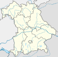
Dimensioni di questa anteprima PNG per questo file SVG: 608 × 600 pixel. Altre risoluzioni: 243 × 240 pixel | 487 × 480 pixel | 779 × 768 pixel | 1 038 × 1 024 pixel | 2 077 × 2 048 pixel | 867 × 855 pixel.
File originale (file in formato SVG, dimensioni nominali 867 × 855 pixel, dimensione del file: 738 KB)
Cronologia del file
Fare clic su un gruppo data/ora per vedere il file come si presentava nel momento indicato.
| Data/Ora | Miniatura | Dimensioni | Utente | Commento | |
|---|---|---|---|---|---|
| attuale | 18:22, 19 nov 2009 |  | 867 × 855 (738 KB) | Alexrk2 | fixed boundaries, rivers; adjusted map projection; colors for internal divisions |
| 21:01, 28 mar 2009 |  | 867 × 855 (1,05 MB) | TUBS | #corrected 4 mistakes (lake margins (pasted to foreground), RegBez and counties around TIR (splited area in two counties and corrected RegBez border), County of Munich (merged), Merged an (to me right know unknown) county north of Nuremberg. #moved all gr | |
| 10:32, 28 gen 2009 |  | 867 × 855 (1,45 MB) | TUBS | {{Information |Description= |Source= |Date= |Author= |Permission= |other_versions= }} | |
| 01:20, 28 gen 2009 |  | 867 × 855 (1,45 MB) | TUBS | {{Information |Description= |Source= |Date= |Author= |Permission= |other_versions= }} | |
| 01:11, 27 gen 2009 |  | 867 × 855 (1,46 MB) | TUBS | {{Information |Description= |Source= |Date= |Author= |Permission= |other_versions= }} | |
| 00:20, 27 gen 2009 |  | 867 × 855 (1,5 MB) | TUBS | {{Information |Description= |Source= |Date= |Author= |Permission= |other_versions= }} | |
| 12:38, 26 gen 2009 |  | 867 × 855 (1,51 MB) | TUBS | == Summary == {{Information |Description= {{de|Positionskarte Hessen, Deutschland. Geographische Begrenzung der Karte:}} {{en|Location map Bavaria, Germany. Geographic limits of the map:}} * N: 50.6303000° N * S: 47.26618 | |
| 12:24, 26 gen 2009 |  | 867 × 855 (1,52 MB) | TUBS | == Summary == {{Information |Description= {{de|Positionskarte Hessen, Deutschland. Geographische Begrenzung der Karte:}} {{en|Location map Bavaria, Germany. Geographic limits of the map:}} * N: 50.6303000° N * S: 47.26618 |
Pagine che usano questo file
Le seguenti 2 pagine usano questo file:
Utilizzo globale del file
Anche i seguenti wiki usano questo file:
- Usato nelle seguenti pagine di af.wikipedia.org:
- Usato nelle seguenti pagine di als.wikipedia.org:
- Usato nelle seguenti pagine di ar.wikipedia.org:
- Usato nelle seguenti pagine di ast.wikipedia.org:
- Usato nelle seguenti pagine di azb.wikipedia.org:
Visualizza l'utilizzo globale di questo file.


