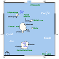
BanksAndRowa_Islands_Map.png (505 × 499 pixel, dimensione del file: 8 KB, tipo MIME: image/png)
Cronologia del file
Fare clic su un gruppo data/ora per vedere il file come si presentava nel momento indicato.
| Data/Ora | Miniatura | Dimensioni | Utente | Commento | |
|---|---|---|---|---|---|
| attuale | 23:45, 28 set 2012 |  | 505 × 499 (8 KB) | Womtelo | Reverted to version as of 05:41, 23 November 2010 |
| 17:31, 28 set 2012 |  | 505 × 499 (14 KB) | Human anatomy | нови държави | |
| 06:41, 23 nov 2010 |  | 505 × 499 (8 KB) | Womtelo | Reverted to version as of 11:48, 9 June 2006 | |
| 06:10, 23 nov 2010 |  | 900 × 801 (154 KB) | Womtelo | I have redrawn entirely the map, based on more accurate data from various maps. I paid special attention to spelling of place names, which I know well, based on personal knowledge of local languages. Village locations and names were massively wrong in the | |
| 12:48, 9 giu 2006 |  | 505 × 499 (8 KB) | Kaus~commonswiki | {{Information| |Description=Banks- and Rowa-Islands, Vanuatu |Source=http://www.aquarius.geomar.de/omc/make_map.html (with modifications from the map author) |Date=04-22-2006 |Author=User:Kelisi |Permission=[http://gmt.soest.hawaii.edu/ GMT homepage] |
Pagine che usano questo file
La seguente pagina usa questo file:
Utilizzo globale del file
Anche i seguenti wiki usano questo file:
- Usato nelle seguenti pagine di bg.wikipedia.org:
- Usato nelle seguenti pagine di nl.wikipedia.org:
- Usato nelle seguenti pagine di pt.wikipedia.org:
- Usato nelle seguenti pagine di ru.wikipedia.org:


